
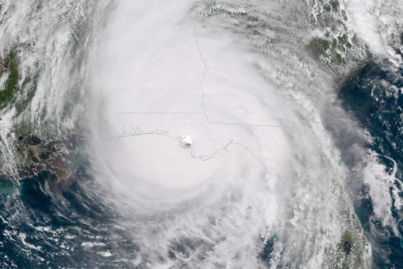
FSU research improves hurricane intensity forecasting
Hurricanes are massive, complex systems that can span hundreds of miles as they swirl around the low pressure of the storm’s eye.
Read More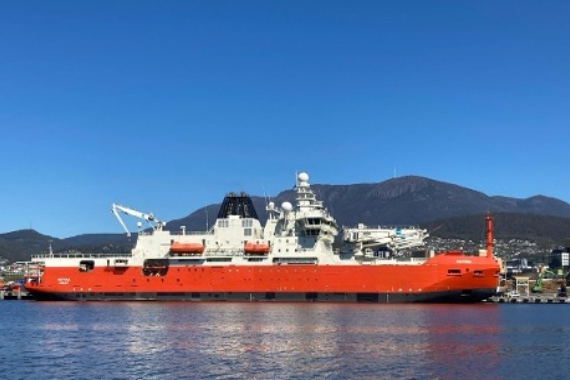
SAMOS Welcomes the RSV Nuyina
We are excited to welcome the Australian Antarctic Program’s (AAP) new research icebreaker RSV Nuyina to the SAMOS initiative’s active recruitment roster. Read More
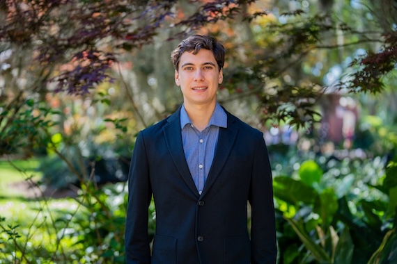
Student Star: Daniel Siegel
"My Directed Independent Study work at COAPS on the SAMOS project encouraged these passions and once again drove home that I do want to engage with science in my professional life and that I’m especially passionate about translating science for people."
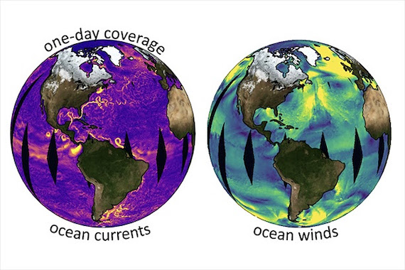
ODYSEA
The competition for two future satellite missions in NASA's Earth System Explorers Program has been narrowed to four mission including Ocean Dynamics and Surface Exchange with the Atmosphere (ODYSEA). ODYSEA is a collaboration between Scripps, JPL, CNES in France, NOAA, the US Naval Research Lab, Florida State University, Oregon State University, WHOI among over 20 collaborators. ODYSEA will measure very high resolution ocean surface winds and ocean surface currents with approximately 90% global coverage each day.
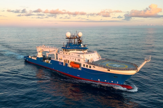
New SAMOS Vessel
We are excited to welcome Schmidt Ocean Institute’s (SOI) new vessel Falkor (too) to the SAMOS initiative’s active recruitment roster. Distribution of Falkor (too)’s preliminary, intermediate, and research quality SAMOS processed files begins with her data collected on 18 September, 2023 in the Galapagos region.
CLICK HERE to learn more about the Schmidt Ocean Institute and Falkor (too)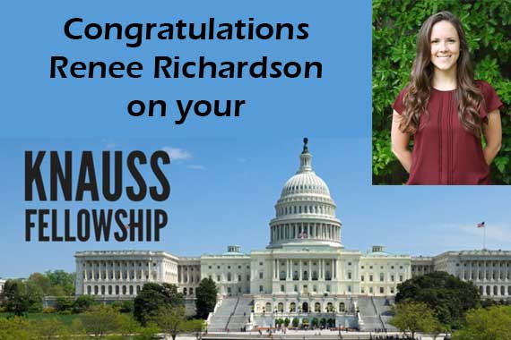
COAPS Student Awarded Prestigious Knaus Fellowship
Graduate student researcher Renee Richardson has been selected as a finalist for the National Oceanic and Atmospheric Administration's 2021 John A. Knauss Marine Policy Fellowship Program.. Read more.
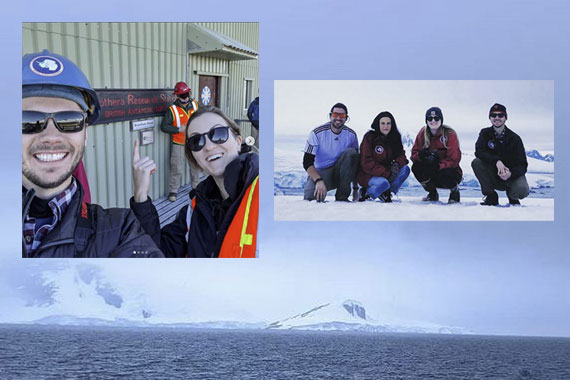
Research at Sea
Oceanography PhD students Thomas Kelly and Natalie Yingling spent time at sea conducting research aboard the RV Laurence M Gould. The research cruise focused on understanding long-term changes in the marine ecosystem off of the Western Antarctic Peninsula. Kelly and Yingling are affiliated with the FSU Zooplankton Ecology and Biogeochemistry Lab directed by Dr. Mike Stukel.
COAPS takes interdisciplinary approach to scientific research about ocean-atmosphere interactions
Source: "Across the Spectrum" Magazine
The Earth’s climate is determined by the extremely complex interplay of land masses, waters and the atmosphere. Everything matters: water temperature, clouds, mountains, swamps, waves, wind and so much more. So it only makes sense that when trying to predict where our climate is headed long term — or whether it will rain on your wedding day — the chances of finding answers are much better when scientists who study all of those things work together. That’s the premise of FSU’s Center for Ocean-Atmospheric Prediction Studies — COAPS for short — which describes itself as a research center that "performs interdisciplinary research in ocean-atmosphere-land-ice interactions to increase our understanding of the physical, social and economic consequences of climate variability." Read more.

Recent Publications
Distinct seasonal climate drivers revealed in a network of tree-ring records from Labrador, Canada
(Source: Climate Dynamics)
On the Generation and Salinity Impacts of Intraseasonal Westward Jets in the Equatorial Indian Ocean
(Source: Journal of Geophysical Research: Oceans)
Time to Flatten the Curves on COVID-19 and Climate Change. Marketing Can Help
(Source: Journal of Public Policy & Marketing)
View All Publications
Building A, Suite 292
Tallahassee, FL 32306-2741
Phone: (850) 644-4581
Fax: (850) 644-4841
contact@coaps.fsu.edu