
Satellite-Derived Upwelling Indices
This website provides access to upwelling index databases and analysis tools for the Global Ocean's coastal regions, derived from satellite-based wind products.
Background information can be found here

Upwelling Maps
Create maps of mean and anomaly upwelling indices computed over user-specified time periods.
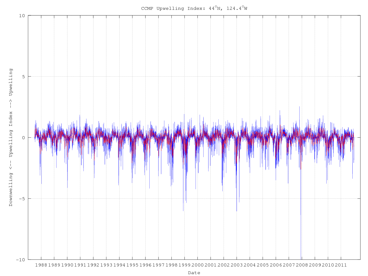
Upwelling Time Series
Create time series plots of upwelling indices (daily and filtered) from any location.
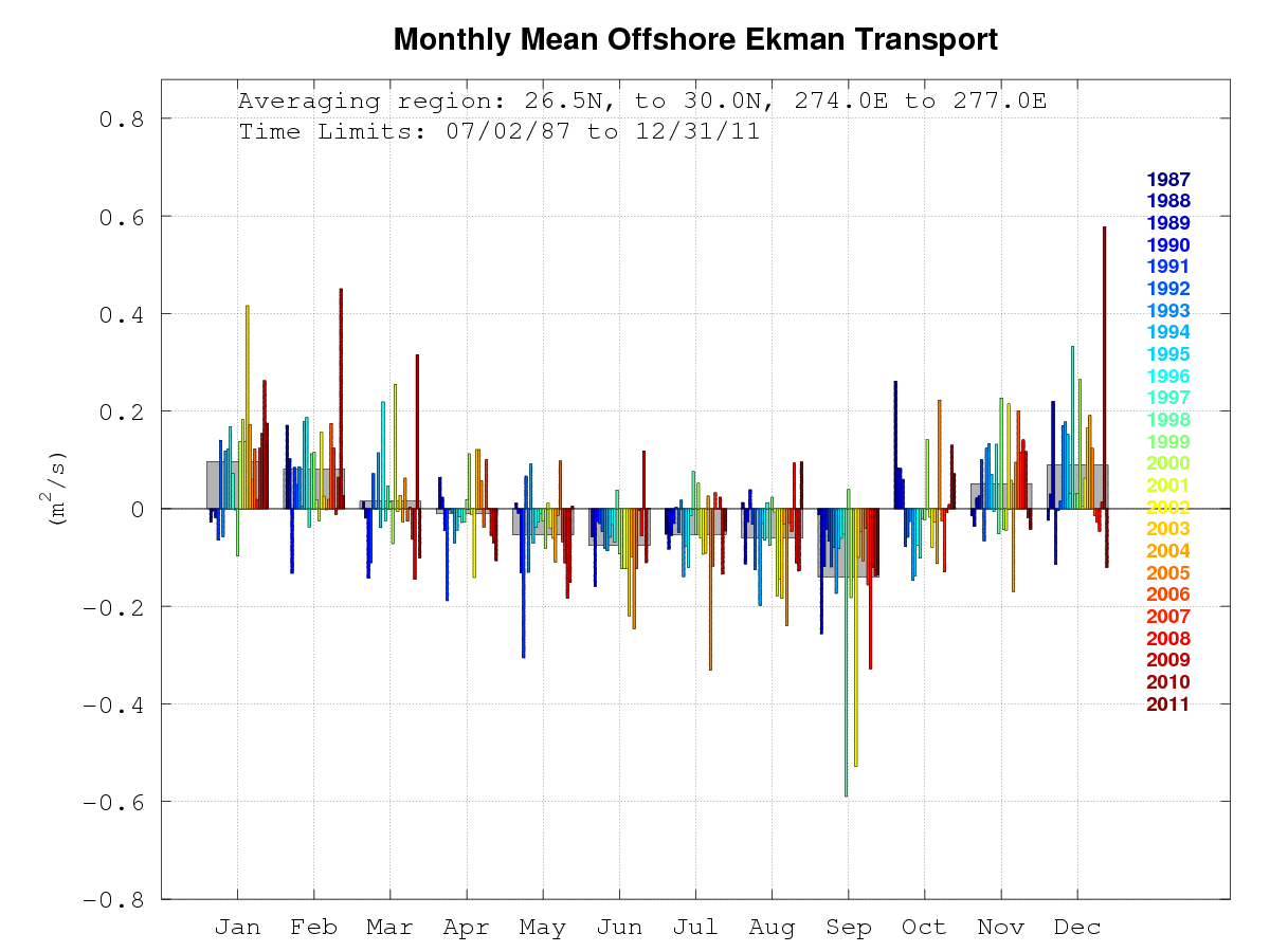
Climatology
Plot monthly climatology and monthly mean upwelling indices averaged over user-specified regions.THREDDS Data Access
These webpages were created by Steven Morey and Daniel Kane of Florida State University.
For all inquiries, please email Steven Morey at
This project was supported by the NASA Ocean Vector Winds Science Team