A core objective of the Center for Ocean-Atmospheric Prediction Studies is providing high-quality data products and services to the public, private, and research communities. We strive to provide well-documented, quality-evaluated data and products, adding value to their use for a wide range of weather, ocean, and climate applications. Principle providers of data products and services are the Florida Climate Center, Marine Data Center, and the HYCOM Consortium. Additional datasets are provided from active and historical projects led by individual researchers and teams at COAPS.
One mission of the Florida Climate Center is to provide climate data for government agencies, private businesses, and citizens of the state of Florida. Typical data requests are for historical observations, climate normals, or observing station summaries. In addition, the climate center will conduct special analyses that are tailored to an individual's need. Minor requests will be filled at no charge, but a fee will be assessed for more extensive and time-consuming request.
The Marine Data Center specializes in collecting, evaluating, and distributing in situ and remotely-sensed, high-quality, marine meteorological and surface oceanographic data. Datasets include underway meteorology and surface ocean data from research vessels (SAMOS, RVSMDC), ocean vector wind (scatterometry), and the well-known monthly FSU winds for the topical Pacific and Indian Oceans.
The HYCOM data server provides easy and fast access to near real-time HYCOM-based 1/12° Atlantic Ocean prediction system output (and other select products). The system provides nowcast and forecasts within a day after the outputs become available, typically once a week on Monday.

AgroClimate
Scientists at the Florida Climate Center, in collaboration with COAPS and the former Southeast Climate Consortium, helped develop AgroClimate, an interactive website with climate, agriculture, and forestry information, to help farmers better manage their crops for maximum outcome. AgroClimate uses crop simulation models along with historic and forecast climate data so farmers can compare probable outcomes under different climate conditions.

Florida Climate Data
The Climate Data and Visualization Tool gives users a chance to examine data from approximately 100 long-term National Weather Service (NWS) First Order Weather Stations, NWS Cooperative Stations, and Federal Aviation Administration (FAA) sites in Florida. The tool has predefined parameters, developed from some of the most common requests received by the Florida Climate Center, and displays data at monthly, seasonal, and annual time scales. The data are computed for the period of record for each station.

FSU Fluxes
COAPS continues operational production of the monthly FSU Winds for the tropical Pacific (v1.2) and Indian Oceans (Legler). The discontinued version 3 of the FSU in situ flux product is also available.

HYCOM (HYbrid Coordinate Ocean Model)
HYCOM.org provides access to near real time global HYCOM + NCODA based ocean prediction system output. The ocean prediction system runs daily at the Navy DoD Supercomputing Resource Center. Upon completion, these data are remotely copied to our local HYCOM.org servers for additional processing. Daily data is typically accessible within 48-hrs of the initial runtime.
JMA
ENSO Index According to JMA SSTA
(1868-2020)
An index of the El Nino Southern Oscillation phases based on the a 5-month running mean of spatially averaged SST anomalies over the tropical Pacific: 4°S-4°N, 150°W-90°W.

Marine Data Center
The Marine Data Center specializes in collecting, evaluating, and distributing in situ and remotely-sensed, high-quality, marine meteorological and surface oceanographic data to the research community in well-documented, easy-to-use formats.

National Park Service
In partnership with the Southeast Archeological Center (SEAC) of the National Park Service (NPS), COAPS identified modern, colonial, and pre-colonial atmospheric and oceanographic data that can be used to assess the risks to irreplaceable cultural resource sites within Canaveral National Seashore and Everglades National Park.
RVSMDC Data
Research Vessel Surface Meteorology Data Center
Prior to the establishment of the Marine Data Center, the RVSMDC, collected and quality-controlled surface meteorological observations from research vessels operated by the United States and the international community. Access data from past projects including TOGA-COARE, WOCE, CLIVAR, and other select research vessel datasets.

SAMOS (Shipboard Automated Meteorological and Oceanographic System) Initiative
The SAMOS initiative is one core activity of the Marine Data Center and provides access to accurate, high-quality marine meteorological and near-surface oceanographic observations from over 40 research vessels from 2005-present.

Scatterometer Products
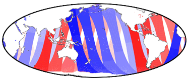
Scatterometers are unique among satellite remote sensors in their ability to determine both wind direction and speed over water. Scatterometer datasets are produced and distributed by COAPS/FSU, through support by the NASA Ocean Vector Winds Science Team and NOAA's Ocean Observation and Monitoring Division.

Southeast US Downscaling
The COAPS Regional Downscaling for the Southeast United States datasets are the result of a USGS-funded collaborative project. They consist of two main components: downscaling of Global Reanalyses (sub-project CLARReS10) for the period 1979-2000, and downscaling of Global Climate Models (sub-project CLAREnCE10) for the periods 1968-2000 and 2038-2070. Click on the sub-project name for details.
THREDDS Server
Thematic Real-time Environmental Distributed Data Services (THREDDS)
THREDDS users can directly access data catalogs for the FSU winds and fluxes, HYCOM, scatterometers, research vessels, and other projects via this service.

